
Eugene Neighbors by Parcel
Public sources around a Eugene address answer different questions. City and County maps show tax-lot geometry, while a County property account can connect a recorded or tax-account owner to one parcel. The relationship between an owner and an occupant cannot be assumed. Oregon voter files have a limited, request-based public channel, and the City neighborhood program helps identify voluntary association contacts. No source below is a complete household directory for the block.
| Source | What It Shows About a Block | Access |
|---|---|---|
| City or Lane parcel map | Adjacent tax lots, boundaries, City or UGB context, and property geography | Free address or tax-lot map tools |
| County property account | Parcel, site address, tax-account fields, and recorded-document clues | Free by address, account, or map and tax lot |
| RLID Maps | Selected parcels and spatial tools, subject to the subscription product | Subscription access; selected parcels are not people lists |
| Oregon voter list | Only elector fields that Oregon law permits in a requested file | Statutory request, fees, exclusions, and use limits |
| Neighborhood association map | Voluntary association area, active contacts, and civic information | City address-based map; no City member roster |
| Permit or land-use file | Public project relationships and address history | Address or parcel searches; not residency proof |
Start with the source that matches the question. A question about which parcels touch an address belongs on a map. A question about the recorded chain belongs with deeds. A question about the local civic group belongs with the association map. Keeping those roles separate prevents an owner field from becoming an unsupported claim about Eugene neighbors.
Parcel work is strongest when it is limited to a clear block question. The subject parcel and its visible neighbors can be checked without creating a broad list. If an adjacent lot is a duplex, condominium, trust-held parcel, or organization-owned property, the account label says nothing reliable about the number of homes or people behind that boundary.
Map Eugene Neighbors by Block
Use the parcel tools as a short geographic process. Eugene Property Explorer accepts an address or an 8-digit map and 5-digit tax lot. Its instructions call for zooming to the result and clicking the tax lot for details. Pan or zoom to the adjoining lots, then compare City limits, UGB, parcel, footprint, and other relevant layers. The map’s geometry is useful context, but its approximate footprint and location data are not a survey or an identity record.
Lane Easy Property Information Lookup provides the alternate address or tax-lot route and links property, tax, permits, sales, and jurisdiction context.
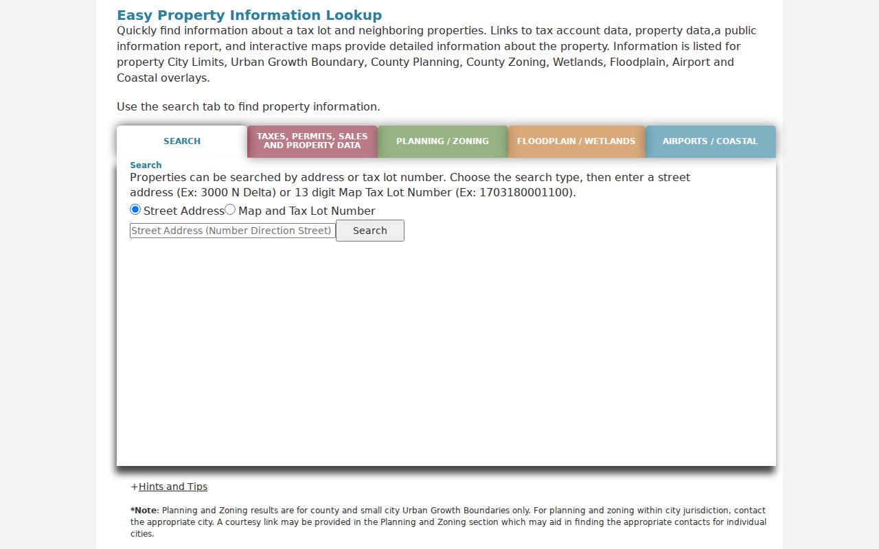
Save the returned tax lot and account before moving to a related tax, map, permit, or recorded-document source.
- Enter the subject street address or known map and tax lot in City Property Explorer or Lane Easy Lookup.
- Open the subject parcel, then click only the visible adjoining parcels needed to understand the immediate block.
- Record the parcel identifiers and labels exactly as displayed, including the difference between site and mailing address.
- Use a deed, permit, or association route for a separate question instead of treating the map as a household list.
For a full named-street record chain rather than the immediate block, use the Eugene street directory after the parcel work is complete.
Eugene Neighbors Across City Edges
Nearby homes can fall under different City and County rules. River Road, Santa Clara, and the Industrial Corridor may be inside Eugene’s Urban Growth Boundary while outside incorporated City limits. A Eugene mailing address or ZIP does not settle that point. Check the City-limits and UGB layers alongside the County parcel. The same caution applies on the northeast edge, where 97408 has a Eugene and Coburg postal designation.
The City’s annexation estimator is designed for certain UGB land outside City limits, but it uses data as of May 21, 2024 and is not proof of current ownership. For an address on a boundary, record the source date and choose the custodian by the actual parcel, record type, and time period. This keeps a neighbor search grounded in jurisdiction rather than postal shorthand.
Note: A boundary on a neighborhood map, a City map, and a postal map can all differ while remaining correct for their own purpose.
Oregon Voter Rules Near Eugene Neighbors
Oregon My Vote is not a block-browsing tool. It is a voter’s self-service route to check or update that voter’s registration, ballot status, election information, and County office contacts. The update and check flow uses the registered name and date of birth. Describing it as a way to browse nearby people would be inaccurate and would disregard the program’s privacy purpose.
Oregon My Vote directs voters to their own registration and ballot functions.
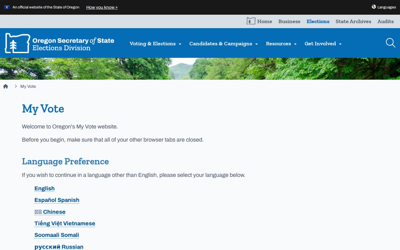
Use My Vote only for the voter’s own account, not to draw conclusions about people nearby.
A public voter list has a different route under ORS 247.945 through 247.955. The statutory fields can include permitted residence or ballot-delivery address, party, birth year, precinct information, phone, and participation information, but protected and ACP records are excluded. Birth month and day, Social Security and driver-license numbers, signatures, and ballot choices are not public. The commercial-use ban and confidentiality rules apply to the file.
Oregon’s voter-list request page describes statewide and less-than-statewide electronic requests, delivery by SFTP, and the expected processing period of up to 10 business days.
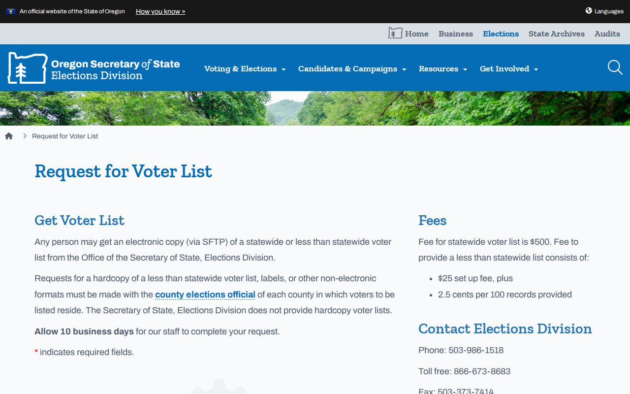
A request channel does not authorize publication or use that would defeat a protected voter’s safety choice.
Eugene Neighbors Association Map
The Eugene Neighborhood Association Program maps an address to the applicable voluntary association and ward, and it links current association sites, social accounts, contact information, and a leaders-contact list. The City recognizes 23 neighborhood-association areas and the current program page reports 18 active groups. These are community and participation resources, not City-maintained member directories or a way to compile households.
The City’s Neighborhood Association Program provides the area map and participation contacts.
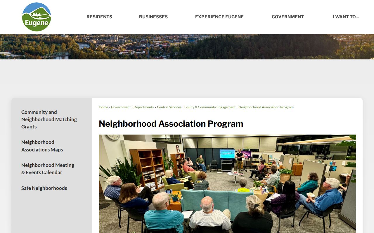
Check the live City map before contacting a group because active status and contact details can change.
Central areas
Downtown Neighborhood Association, Jefferson Westside Neighbors, and Whiteaker Community Council are examples of City-listed voluntary groups.
North areas
River Road Community Organization and Santa Clara Community Organization are useful map labels where City and UGB geography can diverge.
Other active examples
Amazon Neighbors Association, Cal Young Neighborhood Association, Friendly Area Neighbors, Harlow Neighbors Association, and Trainsong Neighbors appear on the City’s active inventory.
Industrial Corridor Community Organization, Goodpasture Island Neighbors, West Eugene Community, and West University Neighbors are listed as inactive names in the City inventory. The City also provides boundary materials for all recognized areas. A boundary can help identify the right voluntary group, but it does not turn the group into a source of resident names.
Eugene Neighbors and Parcel Accounts
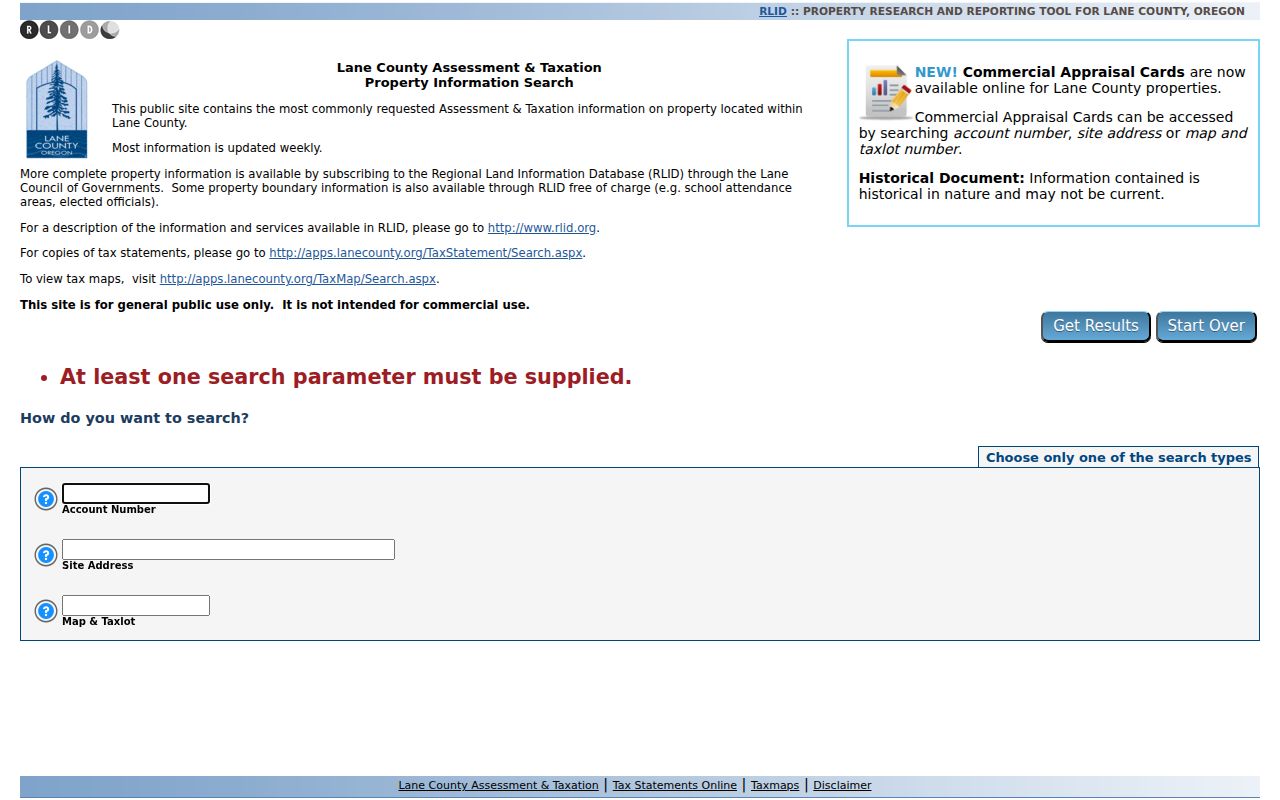
The free Lane County Assessment & Taxation Property Information Search has deliberately narrow fields: choose Account Number, Site Address, or Map and Taxlot, then enter one parameter. It updates common assessment and tax data weekly and links tax statements and tax maps. The basic form does not have an owner-name box. Subscription RLID Standard Search has owner-name capability, so a free public visitor should not be promised that field.
Lane County’s A&T property form shows the public account, site-address, and map-and-tax-lot choices.
A result can show map and tax lot, current parcel or account, status, document number, type, date, effective year, acreage, comments, and legal-description material. Read the labels as tax-account facts. A mailing address or owner label does not identify all people who live at the site.
Eugene Neighbor Tools Compared
Official records are stronger because they identify the source, the date, and the narrow fact shown. A commercial neighbor-lookup category may combine data from different times and sources, merge people with similar names, or retain an old address. It cannot replace a County parcel, City map, court, or elections custodian, and it should never be used to work around a safety protection.
| Tool type | Best use | Important limit |
|---|---|---|
| Official parcel map | Find adjoining tax lots and jurisdiction context | Shows geography, not every household member. |
| County tax account | Confirm parcel or tax-record labels | Owner or mailing field can differ from occupants and site. |
| Voter-file request | Obtain only lawfully available elector data | Confidential and ACP records stay protected; ballot choice is private. |
| Commercial lookup category | At most, identify a fact to verify with a custodian | May be stale, incomplete, or attached to the wrong person. |
Insider tip. If a map result and an address label conflict, save the map and tax-lot identifier first. That identifier is more durable than a broad neighborhood or postal label when asking the appropriate office a narrow question.
Eugene Neighbor Lookup Limits
Renters, household members, utility customers, delivery recipients, DMV data, current vital certificates, and protected voters do not become public merely because an adjacent parcel is visible on a map. Oregon’s Address Confidentiality Program protects participants through a substitute-address process, and voter law excludes ACP and other protected information from delivered files. A parcel owner’s record is not a substitute for data another statute protects.
County and City records can contain errors or fall behind a change in ownership, mailing information, or address assignment. Verify a fact with the record custodian and its date before relying on it. Do not combine separate public sources to infer information that one of them deliberately withholds.
Lawful use. Use information about Eugene neighbors for personal, lawful neighborhood and property research. Oregon law does not permit public records to be used for harassment, stalking, intimidation, or unwanted contact.
When an urgent threat exists, contact local law enforcement or 911 rather than attempting further address research. For a record error, contact the office that created the record and keep its case, parcel, or request reference.