
Eugene ZIP Code Directory Coverage
Seven postal designations appear in Eugene City and state materials: six ordinary Eugene ZIP responses plus 97440. Their broad area labels are useful orientation, not boundary proof. The City survey material uses 97401 through 97405 and 97408 for Eugene. State geographic material also identifies 97440 for Eugene and gives 97408 a Eugene and Coburg post-community designation. Confirm the current result for a precise address with the Postal Service before adding it to a record trail.
| ZIP | Areas Covered | Post Office | Notes |
|---|---|---|---|
| 97401 | Downtown, central Eugene, and riverfront-oriented central areas | Eugene standard ZIP | Check the delivery edge by address; parcel and ZIP logic differ downtown. |
| 97402 | West Eugene, Bethel, and airport-industrial-side orientation | Eugene standard ZIP | Edge areas can need a City, County, or UGB parcel check. |
| 97403 | University of Oregon and east-central, campus-adjacent areas | Eugene standard ZIP | University mail use does not identify a private off-campus address. |
| 97404 | North Eugene, River Road, and Santa Clara orientation | Eugene standard ZIP | Important City, UGB, and County mismatch zone. |
| 97405 | South Eugene, Amazon, and hills-side orientation | Eugene standard ZIP | Map and tax lot are stronger than a broad ZIP near rural edges. |
| 97408 | Northeast Eugene, Cal Young, Harlow, and Coburg-edge orientation | Eugene / Coburg standard ZIP | The shared post community is not a jurisdiction decision. |
| 97440 | Eugene postal designation, including PO-box or business-mailing use in records | Eugene | Verify the present Postal Service class for the specific address or box. |
Postal designations change and delivery edges are address-specific. The USPS ZIP Code Lookup is the official final check, while the County and City maps answer different questions about the parcel.
The table intentionally does not claim a ZIP-wide count of homes or people. City survey material supplies the six ordinary Eugene categories, and state material supplies the additional postal designation, but a postal code is not a stable neighborhood boundary. A complete address, current USPS response, and mapped parcel remain the useful set of facts for a specific Eugene record question.
Eugene ZIP Code 97404 Checks
97404 covers a broad north Eugene orientation that includes River Road and Santa Clara. Those places show why a Eugene ZIP code directory cannot stand in for a jurisdiction search. River Road, Santa Clara, and the Industrial Corridor can be inside the Eugene Urban Growth Boundary while remaining outside City limits. A city-record request, city permit file, or county tax record may therefore have a different custodian even though the mailing city says Eugene.
Use Eugene Property Explorer to compare the address or tax lot with City limits and UGB layers. Then use the County parcel route for assessment ownership or tax-account information. The City annexation estimator is a separate local tool for UGB land outside City limits, but its estimates are not present ownership proof.
Records can be held by different offices only a short distance apart. Eugene Property Explorer supplies City geography and property-report links, while Lane County Assessment and Taxation supplies the tax account. A City permit is a separate PDD record. Starting with the right jurisdiction prevents a broad request from being sent to an office that is not the record custodian.
Note: A ZIP describes postal routing, while an incorporated boundary describes the government jurisdiction for a particular parcel.
Eugene ZIP Code 97408 Edge
97408 is the local postal quirk that needs the most caution. The state geographic standard lists Eugene and Coburg as its post communities. It is associated with northeast Eugene, Cal Young, Harlow, and the Coburg edge, but the city name printed in an address does not determine whether a property falls in Eugene, Coburg, or unincorporated Lane County. Start with the full address, then inspect the parcel and jurisdiction layers.
That sequence also avoids a common error with a tax mailing address. A tax account can carry a mailing address that is different from the site, or physical, address. The assessor record may reflect an owner, trust, agent, or organization receiving tax correspondence. The site address, map and tax lot, legal description, and postal ZIP each answer a different part of the same address question.
Verify a Eugene ZIP Code
USPS supplies three official lookup paths: street address to ZIP, city and state to ZIPs, and ZIP to city. It standardizes postal formatting. Its result does not prove that a person or organization is present at the address. For that reason, use the ZIP lookup before an address-based record search, not as evidence about a household. The current form provides an optional Company field and requires Street Address with either City and State or ZIP.
| USPS field or route | Required | What it verifies |
|---|---|---|
| Street Address | Yes for address route | Standardized address and ZIP formatting. |
| City and State or ZIP | One alternative is needed | Postal context for the address search. |
| Company | No | Optional delivery-format detail, not occupancy evidence. |
| ZIP to city lookup | ZIP needed | Postal city association, not parcel jurisdiction. |
Myth. A valid USPS result confirms postal formatting only. It is not a city-limit map, a parcel-boundary map, or a way to verify a person at an address.
If USPS formats an address differently from a County or City record, preserve both versions and compare the map and tax-lot identifiers. Units, ADUs, and alley-access homes can have address-assignment rules that make the difference meaningful. Do not overwrite an older record’s address with a current postal version before confirming that it identifies the same place.
Finding Eugene Residents by ZIP Code
A ZIP rarely produces a ready-made resident list in Eugene's official tools. The free Lane A&T property form has no ZIP field. It accepts Account Number, Site Address, or Map and Taxlot. Lane Easy Property Lookup likewise starts with a street address or 13-digit map and tax lot. My Vote is a voter’s own registration tool, not a ZIP browser. A voter-file request has a lawful channel, but its scope and use stay subject to the elections system and ORS 247.945 through 247.955.
- Use USPS to standardize the known street address and retain the ZIP only as postal context.
- Enter the address in Lane Easy Property Information Lookup or the County A&T form.
- Save the returned site address, tax account, map and tax lot, and jurisdiction rather than inferring them from the ZIP.
- Use an address-keyed permit, land-use, or recorded-document route only after the parcel has been identified.
Once the postal area has narrowed to one street, the Eugene street directory has the address-by-address property and record sequence. ZIP granularity should remain a way to orient the search, not a replacement for it.
Requested voter data also needs careful treatment. Although the statewide file specification can include ZIP and ZIP+4 fields, My Vote does not browse by ZIP, and the free County property form has no ZIP-wide search. A field in an official export does not create a right to publish or repurpose names at nearby addresses. Use the requested file only under the terms and confidentiality limits that govern it.
Eugene ZIP Directory Address Fields
Keep four labels together when a Eugene ZIP code directory search becomes a records search. The site or situs address is the physical location in the street-number system. Map and tax lot identify the assessment parcel. A legal description, such as a lot and block or other recorded land description, is the deed key. A mailing address is where tax correspondence goes. A current ZIP is the postal routing label. They can legitimately differ without showing that a record is wrong.
The City Addressing program assigns and maintains addresses in the City and Eugene UGB. Units, ADUs, and alley-access homes can have special unit or street assignments. For an old address, City Survey Location Books, plats, and the legal description may provide a better bridge than rerunning a modern ZIP lookup.
Eugene Permit Records by ZIP
A ZIP is not a permit-search field, but it can help organize an address that needs a City record. Eugene Building Permit Services documents searches by permit number, address, map and tax lot, person or business, and contractor. Online permit, inspection, and certificate records run from June 1998 to current. Earlier information requires a tailored Building and Permits public-records request for each address, with a possible fee and an estimated processing period of up to 10 business days.
Eugene's permit-search landing page shows the address and parcel-based search choices.
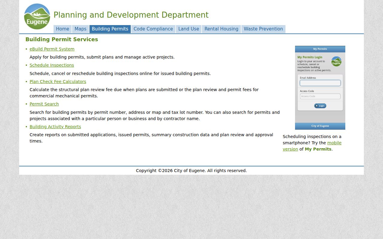
Read a permit's date, type, status, address, and map and tax lot together. It is evidence of a public project relationship, not proof that an applicant or contractor resides there.
Insider tip. A real permit number does not authenticate a fee demand. Lane County warned in August 2026 that it never asks for land-use payment by wire transfer, cryptocurrency, or gift cards.
Eugene ZIP Codes and City Limits
Postal ZIPs, City limits, the UGB, County jurisdiction, neighborhood areas, school boundaries, and tax parcels are separate geographic layers. Do not use a broad ZIP name to choose a record custodian. Compare the parcel with City limits and UGB, then select the agency and record type. This is especially important near River Road, Santa Clara, the Industrial Corridor, and the 97408 postal edge.
- ZIP versus ZIP+4
- A ZIP is a broad postal routing code. ZIP+4 adds a smaller delivery segment and is still not a parcel boundary.
- PO-box ZIP
- A postal designation used for box service. It does not establish a physical delivery address.
- Unique ZIP
- A ZIP assigned for a particular organization or delivery purpose. The research does not verify one for Eugene's general residential record trail.
- Carrier route
- A delivery route within postal operations, not a public property or household directory.
Note: Preserve the full verified address and parcel identifier when a ZIP boundary looks simple but the official map shows a different jurisdiction.